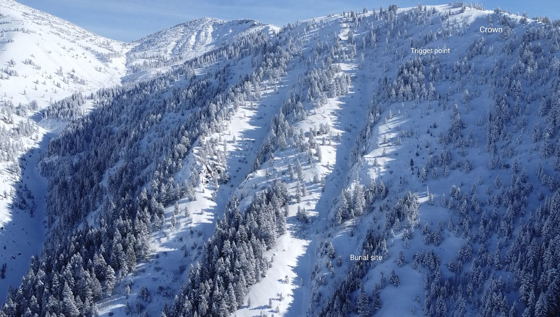
Salt River Range, Wyoming
On Saturday, January 14, 2024, at approximately 11:30 AM, a skier unintentionally triggered an avalanche on a mid-elevation (~8,500’), northwest-facing, sparsely treed slope above an indistinct gully on the Northwest Face of Little Poudre Mountain. This large, soft slab avalanche filled a relatively narrow path (SS-AS(u)-R3-D2). The area was too dangerous for a crown profile. Still, it is assumed that the avalanche broke on a layer of near-surface facets and surface hoar responsible for a widespread avalanche cycle in the region. The weak snow layer formed during a prolonged dry period in December that was buried by approximately 30” of snow falling during a series of storms that began on January 4th. The avalanche broke approximately 50’ wide and 1-3’ deep and entrained more snow along the flanks of a shallow gully. The avalanche fell approximately 600 vertical feet. The slide path is one of several sparsely wooded avalanche paths on the northwest face of Little Poudre Mountain that run the full 1,200’ length of the face. This avalanche was one of the dozens reported in the region during a particularly active avalanche cycle.
BTAC staff are grateful for the information shared by the party involved. Sharing experiences like this openly is difficult but critical to creating an opportunity for the community to better understand and learn from these tragedies. Our sincere condolences to family, friends, and others impacted by this loss of life.
We are grateful for the efforts of Star Valley Search and Rescue and Teton County Search and Rescue to perform this mission in dangerous conditions and the county Sheriff’s offices in Teton and Lincoln County for allowing BTAC personnel on the scene to begin the research needed to produce this report.
View the full report here.
